NET-AAO Kolhorn H*
Town Kolhorn
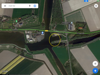
Location East of steam pumping station, at new locks
Position Lat (dms) 52°47’28” N
Position Long (dms) 5°54’52” E
QTH-locator JO22KS
Year built -
Material -
Height construction (m) -
Height light (m) -
Range light (mi) -
Characterisic -
*Note August 2020: Needs more research for an ARLH-application.
Additional information:
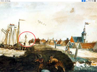
The location (locally known as Scheepshok) had a harbour for transhipment and fishery and probably two harbour-lights in line on the northern pier head at least since 1880.
The historic harbour town Kolhorn shifted land inwards as a result of land reclamation of Wieringerwaard (1610), de Waard- en Groetpolder (1844) and finally Wieringermeer (1930). Since 1930 the harbour with the lights is no longer there. No new lights, no physical evidence of the old lights and no replica or memorial eighter. A solid “H” for “historic site”.
The former fishing fleet of Kolhorn can be recognized by KH as vessel registration.
Last updated: August 2020